The City of Launceston strives to maintain a healthy natural environment for its residents.
We work closely with relevant bodies and organisations to achieve this, but there are also steps you can take to be proactive towards Launceston and our natural environment. Learn more about waterway health, biodiversity, air quality and more in the following sections.
The area now known as Launceston was first settled by a British garrison in 1806 and development followed English trends. Launceston Council was formed in 1853.
With the population approaching 10,000 it was time to ensure a fresh water supply and then a drainage system to enable the city to develop further. The drainage system adopted followed European practice of the time (i.e. combined sewerage and stormwater drains).
Launceston’s combined sewer and drainage system is almost unique to Tasmania and Australia.
For the combined system area it is permissible to have both sewage and stormwater in one pipe rather than the two separate pipes found in most other urban areas of Tasmania. The benefit of the combined system is that during light rainfall events stormwater gets treated at the STP. However, during higher rainfall events, the stormwater flow exceeds the capacity of the pumping systems to the STP, causing a mix of stormwater and sewage to discharge to the estuary or river. Stormwater flows are significantly greater than sewage flows and therefore the system is sized (to the design standard) to accommodate stormwater.
There have been four major iterations of the system over 160 years, each a major generational improvement.
The 1960s version of the drainage system in the combined area is complicated by the need to pump the stormwater flows from the low-lying areas up and over the levee system built to protect the urban area from South and North Esk river floods. Each of the system iterations moved the major sewer outfalls further away from the city centre and down the estuary where the larger body of water was better able to cope with the introduced pollutants.
Sewage treatment did not commence in Greater Launceston until the 1960s and secondary treatment including disinfection was not achieved until the early 1990s.
To combat two of the major contributors to poor waterway health, the River Health Action Plan was developed in December 2017 as part of Launceston's City Deal. A total of $140.7 million is being invested by the Australian and Tasmanian governments, the City of Launceston and TasWater to improve the health of the estuary. This includes $129.2 million for upgrades to the combined drainage system and $11.5 million for catchment management actions.
Significant progress has already been made on both programs, including addressing urban stormwater quality, planning and design of major upgrades to the combined drainage system, and broad-scale fencing and effluent improvements on grazing and dairy farms in the catchment.
TasWater is responsible for stormwater within the combined area (Water and Sewerage Industry Act 2008). The local Council, under the Urban Drainage Act 2013, is the entity responsible for the public stormwater system in Tasmania.
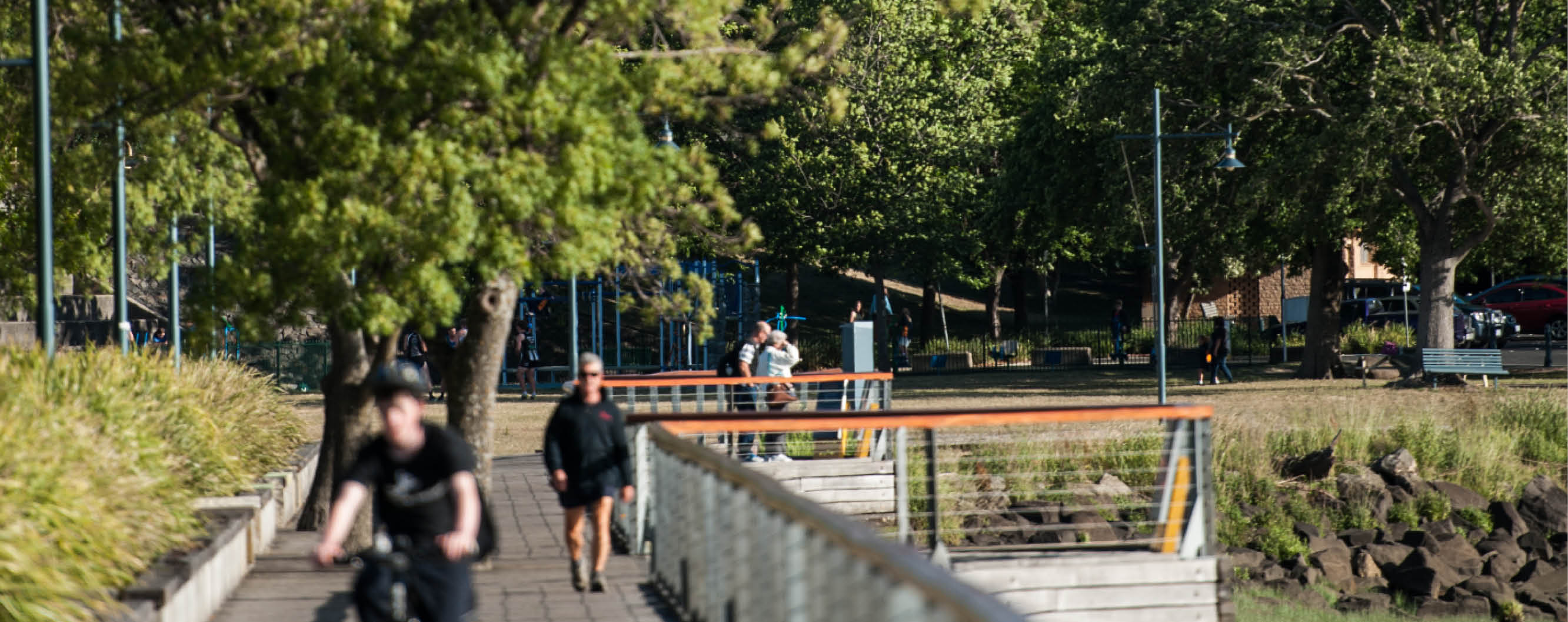
With Launceston at the confluence of the North and South Esk rivers and the Kanamaluka/Tamar Estuary, the City of Launceston recognises the vital importance of long-term, sustainable care of our waterways.
The intertidal mudflats in the upper reaches of Kanamaluka /Tamar Estuary have been formed by a natural sedimentation process where the fresh water meets the sea. The rate of sedimentation and flushing in the estuary, which results in a low capacity channel, is more related to the hydrology of the estuary than to the amount of sediment input. Managing water quality and sedimentation at the confluence of these waterways is a complex issue.
The City of Launceston is committed to health urban waterways. A recent project undertaken as part of the City Deal's River Health Action Plan investigated the stormwater network for sources of sewage pollution. During this project, 44 sewage intrusions were identified in the urban stormwater system. Once the identified intrusions are rectified, an estimated 13.2ML/annum of raw sewage will be prevented from entering our waterways and ultimately the Kanamaluka/Tamar estuary.
Through the Tamar Estuary and Esk Rivers (TEER) Program and the Tamar Estuary Management Taskforce (TEMT) the City of Launceston works closely with partners to provide a coordinated approach to estuarine and catchment management.
How can you help?
Our stormwater network is designed to carry rainwater away from urban areas to prevent flooding. The stormwater network is connected to urban waterways, such as Kings Meadows Rivulet and Newhnam Creek. Only rainwater should end up in our creeks and rivers.
You can help keep our waterways clean and healthy by:
- Picking up your litter, including cigarette butts, plastic bags and other rubbish
- Cleaning up after your dog when out for a walk
- Prevent soil and garden waste from entering the stormwater system
- Wash your car at a carwash, or on the lawn
Launceston and the Tamar Valley have very good air quality for much of the year, providing a much healthier environment than many of the larger cities in Australia.
The topography of the valley makes the city and its surrounds visually attractive and provides residents with magnificent views from thousands of vantage points. However, this topography, when combined with calm winter days and extensive use of wood for heating, is the cause of poor air quality in winter.
The prevailing meteorology creates extended periods of cold, calm conditions over much of the valley in autumn and winter. View more information from the Bureau of Meteorology on the climate of Launceston.
Air quality in Tasmania is monitored by the Environment Protection Authority. The Base Line Air Network of EPA Tasmania (BLANkET) is a network of 29 small air quality stations. View current BLANkET Data to monitor the air quality in your area.
For information regarding air quality and reducing air pollution, please visit the EPA Tasmania website.
The City of Launceston manages more than 1400-hectares of bush and grassland across the municipality, including the iconic Cataract Gorge Reserve.
These reserves provide important tourism and recreational opportunities, protect threatened vegetation communities, provide habitats for a diverse range of plants and animals, improve water quality, enhance visual and landscape amenity and conserve cultural and heritage values.
Many of these reserves are located on the urban interface and contain bushfire-prone vegetation. While the City of Launceston has undertaken fuel reduction activities for many years including a planned burning program with assistance from Tasmanian Fire Service, a review of bushfire management practices is underway.
The Bushfire Management Strategy(PDF, 61MB) was endorsed by the Council in February 2016. This document describes the approach to managing bushfire risk for land managed by City of Launceston.
Fire Management Plans
Fire Management Plans for the bushland reserves are being reviewed based on detailed field assessments of the fire risk to guide mitigation activities. This includes establishing and maintaining Fuel Modified Buffer Zones (FMBZ) along the interface with private properties, upgrading access tracks and planned burning activities to manage fuel loads within the reserve.
Reserve Fire Management Plans have been completed for the following reserves:
- Cambridge Street Reserve
- Carr Villa Bushland
- Cataract Gorge Reserve (including Hardwicke Street Reserve)
- Distillery Creek Gorge and Waverley Lake Park
- Freelands Lookout
- Granville Street Reserve
- Havelock Street Reserve
- Lilydale Area Reserves
- Los Angelos Road Bushland Reserve
- Machen's Reserve
- Meadow Ridge Reserve & Southgate Drive Park
- Punchbowl Reserve
- Ravenswood Area Reserves
- Russells Plains Farm
- Tasman Highway Bushland
There is also a vegetation management plan for low risk reserves.
Works to FMBZs will occur generally from October to December before the bushfire season. Planned burning primarily occurs during autumn but may also be planned for spring depending on the season.
For more information on preparing your property for the bushfire season visit the Tasmania Fire Service or our Bushfire page.
See our Pollution page for information about wood smoke and backyard burning.
Fire Abatement
City of Launceston Council Regulations Officers undertake assessments on vegetation and weeds that are overgrown or will contribute to a fire hazard as conditions dry and the fire season approaches.
Officers assess the fuel load, type of vegetation, fire breaks and the threat to neighbouring properties and assets. The work is to ensure land owners adopt a proactive approach to maintaining the vegetation on their properties.
Council Officers will send an abatement notice under section 200 of the Local Government Act to the property manager and if no action is undertaken to mitigate the fire risk and reduce the fuel load we will arrange a contractor to remove the vegetation at the property owner's expense.
If you unsure if your property or a neighbouring property is maintained to the required standard please contact Customer Service and one of our staff will be happy to assess the vegetation and assess the risk.
Fuel Reduction Program - Autumn 2026
For information about the Autumn 2026 Fuel Reduction Program in Launceston, visit the Current and Upcoming Works page.
Launceston is renowned for its parks, gardens and trees. Trees and green open spaces provide many benefits.
Visit The Urban Forest page to learn more about trees in the Launceston municipality.
Located at the confluence of two major river systems and the Kanamaluka/Tamar Estuary and surrounded by bush-covered hills, Launceston has abundant biodiversity.
The 4500-hectare Tamar Conservation Area provides habitats for invertebrates, fish, migrating birds, wetland species and a nursery for marine species.
The Trevallyn Nature Recreation Area and the Cataract Gorge reserve located on the edge of the City is home to hundreds of plant and animal species. Some of these are not found anywhere else in the world such as Plomley's trapdoor spider and the Cataract Gorge snail.
Carr Villa Flora Reserve has a hundred plant species including orchids and lilies in just 6 hectares. It comes alive in spring with a profusion of flowers.
The interconnected green spaces across Launceston provide habitats for a wide variety of birds and mammals, including the eastern barred bandicoot, to move across the City. The City of Launceston and dedicated groups of volunteers actively manage these spaces to maintain and promote biodiversity within the municipality.
Read more in our Native Plants of the Cataract Gorge Reserve brochure(PDF, 7MB).
The City of Launceston is required by Section 177A of the Local Government Act to keep a list or map to indicate public land.
View the Public Land list online
As part of the River Health Action Plan the City of Launceston is undertaking sewage intrusion investigations across Launceston.
The program allows us to better understand how our separated sewerage and stormwater infrastructure is functioning, and to identify crossed connections which can result in raw sewage entering the stormwater system and — ultimately — our waterways.
Through the use of remotely operated cameras, stormwater infrastructure is inspected for potential crossed connections. When potential problems are identified, Council staff or contractors may seek permission to enter individual properties to conduct 'dye testing'.
This involves pouring special dye into sewerage connections to allow crossed connections to be pinpointed below ground. To date, the program has identified nearly 40 sewage intrusions across Greater Launceston.
It's estimated these have been contributing 9.6 mega litres of sewage and grey water into our waterways each year.
Frequently Asked Questions
What is this program seeking to achieve?
The Sewer Intrusion Investigation Program is seeking to identify 'crossed connections' which can result in raw sewage pollution in Launceston's stormwater catchment.
The Council or its contractors have requested access to my property for dye testing. What does this involve?
In some circumstances, the Council or its contractors may request access to your property to conduct dye testing. This involves an inert dye being poured into toilets or drains. The dye will not cause any harm to plumbing or pipes, or the environment.
Who is responsible for a crossed connection on my property?
The property owner is responsible for crossed connections, and may be in breach of the Urban Drainage Act if they are not rectified.
A crossed connection has been identified on my property. What do I need to do?
Under Section 18 of the Urban Drainage Act 2013, a person must not discharge, or cause or permit to be discharged, anything other than stormwater into a public stormwater system.
If a crossed connection is identified on your property, sewage intrusions must be rectified within 28 days.
A crossed connection has been identified on my property. What can the Council do to help?
The City of Launceston may be able to provide infrastructure maps or plans, information about the location of sewage intrusions and property information to assist you to rectify crossed connections on your property.
I have rectified a crossed connection on my property. Is there anything else I should do?
Please contact the City of Launceston to let us know you have addressed the problem.